Using UAVs to Document the Past
Dr. Gerardo Gutiérrez, Associate Professor in the Department of Anthropology, is working with his lab to breach the divide between social sciences and engineering.
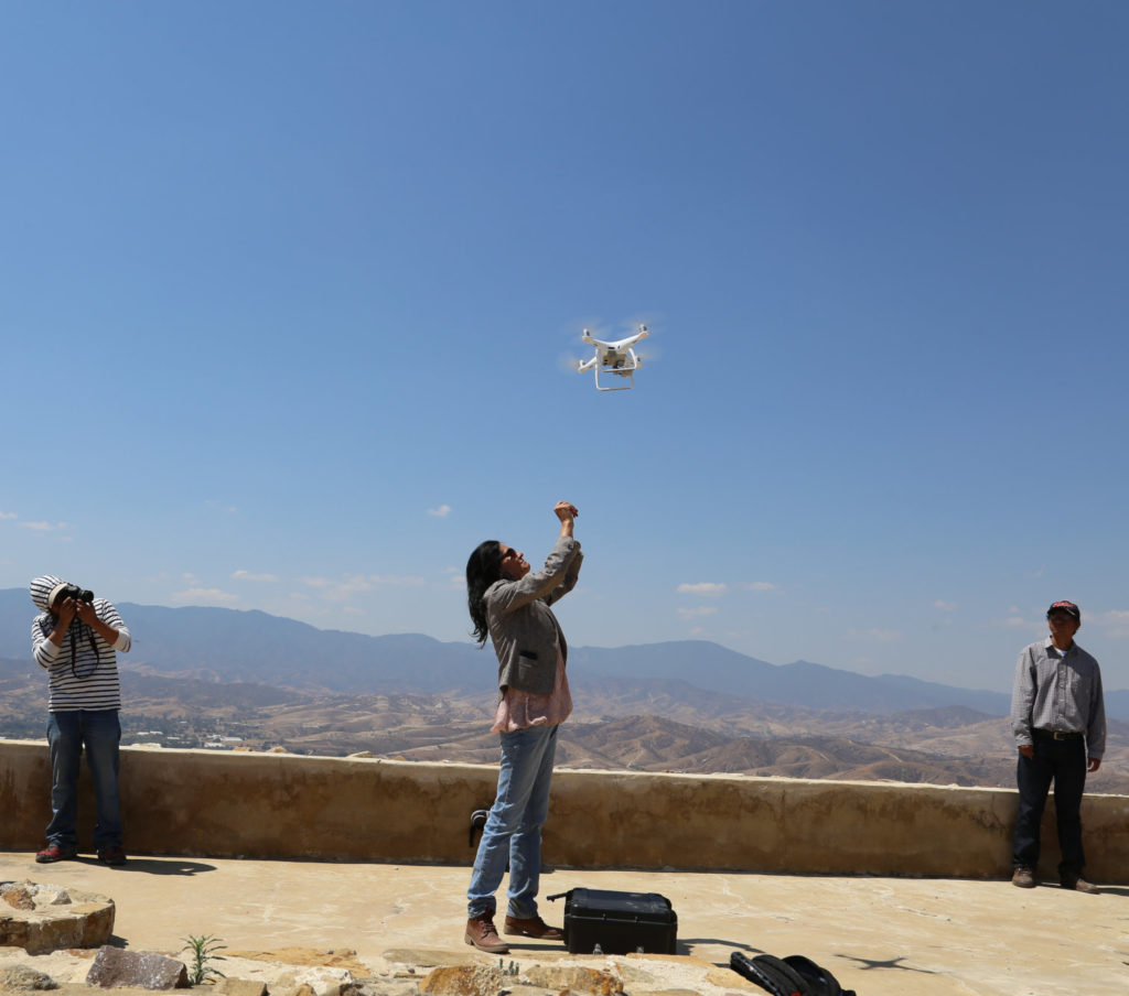
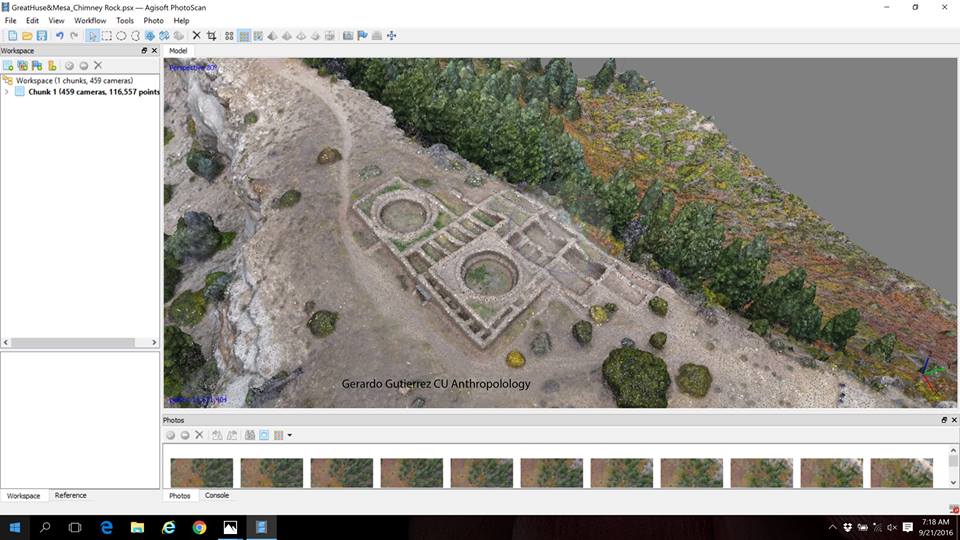
As the Principal Investigator of Project Map, sponsored by the CU Boulder Grand Challenge, Dr. Gutiérrez has worked with his students to use LiDAR, hyperspectral sensors, photogrammetry, and UAV platforms to survey and analyze numerous Colorado monuments, including Chimney Rock National Monument, Fort Vasquez, Bent’s Old Fort, and even the Norlin Library of the University of Colorado-Boulder.
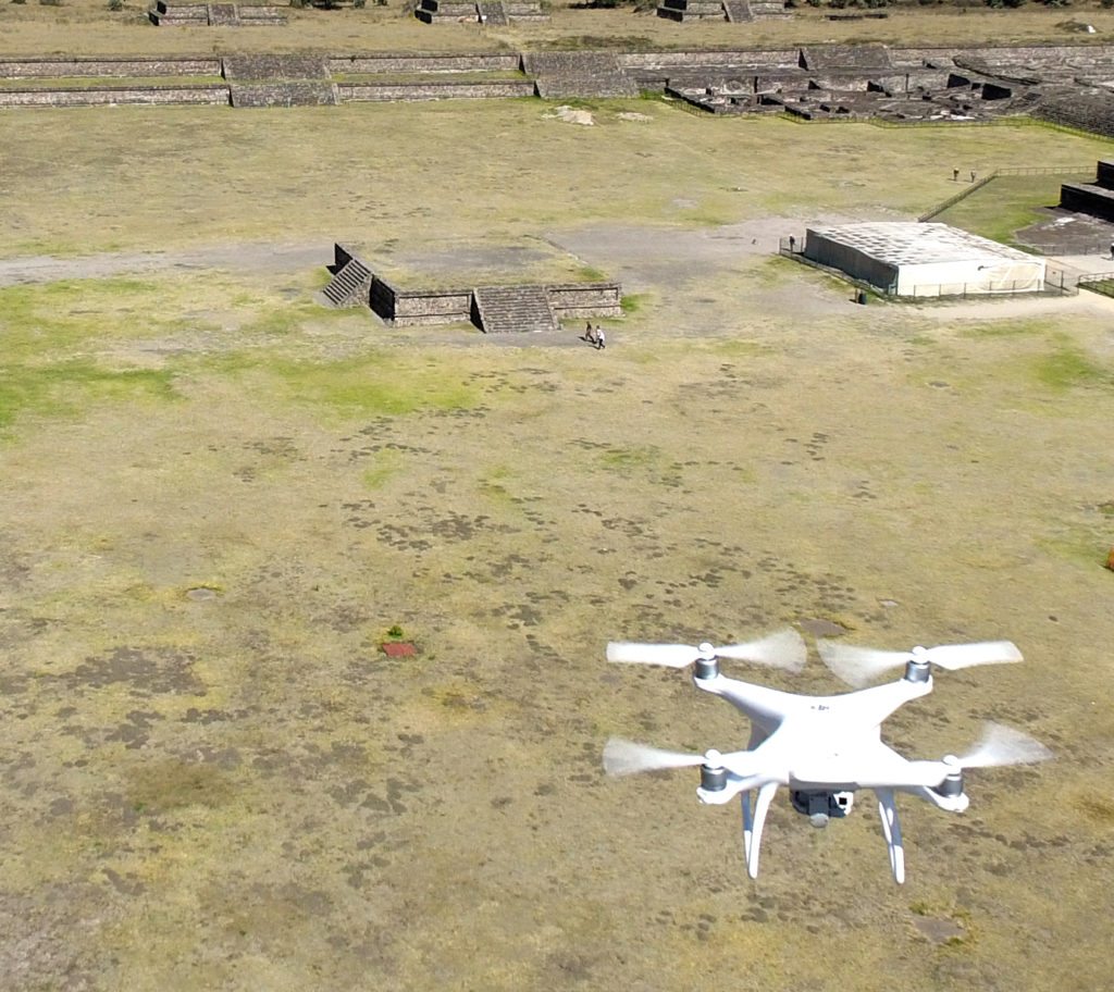
Additionally, in the past year, and over the course of hundreds of drone missions, the Gutiérrez lab has created 3D models for more than 100 archaeological and geomorphological locales, including iconic archaeological sites of Mesoamerica, such as Teotihuacan, Monte Alban and Cuicuilco.
Project Map’s journey through the Grand Challenge started with designing and building drones that fit their needs and experimenting with different sensors to assess potential applications. In particular, because their mapping excursions often take place in isolated, difficult to access locations, Dr. Gutiérrez has promoted the acquisition of portable remote sensing instruments for novel uses.
Beyond technical applications of the UAV platform, however, the primary goal of Project Map is to develop and streamline methodologies for efficient and ethical uses of drones in all fields of the Arts and Sciences. It looks for new questions social scientists can address that were impossible to attempt without the point of view provided by drones.
“One of my primary concerns is education,” Dr. Gutiérrez says. “Thanks to Project Map, I have been able to train more than 70 researchers in three countries on how to formulate research questions that can be answered by the use of new technologies. Once they define their questions, we figure out the best UAV platform and remote sensors for them, and design the most appropriate methodology to collect big data sets to test their hypotheses.”
Dr. Gutiérrez applies his drone-centered methodology to numerous questions in the social science, including Territorial Organization, Landscape and Urbanism; Ethnohistory; Disaster and Risk Reduction based on the anthropological study of vulnerability and risk; and Demography and Migrations.
“Worldwide, drones have become tools empowering researchers and small government units to monitor and study the state of forests, water, antiquities, fauna, and infrastructure on a limited budget. And I expect to continue my activities in the Research and Development of Unmanned Aerial Vehicles and their applications for Arts and Sciences in the future to come.”
To see more of the work done by Project Map, please visit the lab’s Sketchfab page.
–IRISS and the CU Boulder Grand Challenge, taken from https://www.colorado.edu/iriss/2017/03/17/project-map-using-uavs-document-past