Bent Old Fort
- Post By: admin
- Date:
- Category: Case Studies, USA
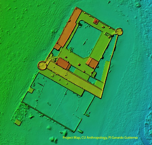
Project Map used both LIDAR and UAV photogrammetry and remote sensing at Bent’s Old Fort for recording the historical heritage of Colorado.
LIDAR Video
[fvplayer src=”http://project-map.org/wp-content/uploads/2018/06/bentFort.mp4″ splash=”http://project-map.org/wp-content/uploads/2018/06/bent.png” width=”1280″ height=”720″]